Attribute Set : Mapping Service_Cartography
Mapping Service_Cartography
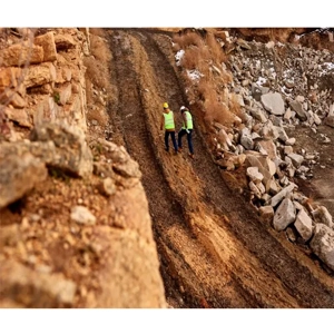
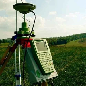
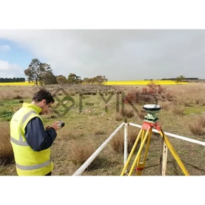
Service Description : Our IP-S3 Mobile Mapping solution delivers high-precision, high-density 3D point cloud data combined with 360° high-resolution imagery for fast and accurate geospatial data collection. Designed for efficiency and reliability, this vehicle-mounted system integrates GNSS, LiDAR, cameras, and inertial measurement technology to capture detailed spatial information across large areas in a short period of time.
With advanced data acquisition capabilities, the system collects millions of measurement points per second while operating at normal traffic speeds, significantly reducing field time and minimizing the need for repeated site visits. The integrated workflow ensures accurate positioning, seamless synchronization of images and point clouds, and immediate visualization for faster and more informed decision-making.
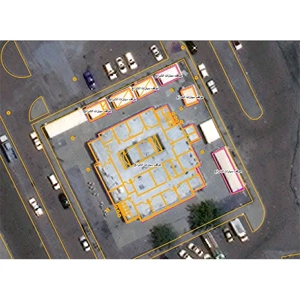
Our mobile mapping services support road and highway surveys, urban infrastructure documentation, asset inventory and management, corridor and utility mapping, construction monitoring, and 3D city modeling. Processed outputs are fully compatible with leading GIS and CAD platforms, enabling efficient data analysis, project planning, and long-term asset management.
Our IP-S3 Mobile Mapping solution delivers high-precision, high-density 3D point cloud data combined with 360° high-resolution imagery for fast and accurate geospatial data collection. Designed for efficiency and reliability, this vehicle-mounted system integrates GNSS, LiDAR, cameras, and inertial measurement technology to capture detailed spatial information across large areas in a short period of time.
With advanced data acquisition capabilities, the system collects millions of measurement points per second while operating at normal traffic speeds, significantly reducing field time and minimizing the need for repeated site visits. The integrated workflow ensures accurate positioning, seamless synchronization of images and point clouds, and immediate visualization for faster and more informed decision-making.
Our mobile mapping services support road and highway surveys, urban infrastructure documentation, asset inventory and management, corridor and utility mapping, construction monitoring, and 3D city modeling. Processed outputs are fully compatible with leading GIS and CAD platforms, enabling efficient data analysis, project planning, and long-term asset management.