No Logo
0
Click To Enlarge Image

Aerial Photography Service

(0 reviews)

  • Supplier : Georeference Engineering Consultants
  • Service Providers : We offer drone-based surveying and aerial mapping solutions to capture accurate, high-resolution data from above. The service includes drone surveys for site assessment, generation of orthophotos for precise georeferenced imagery, and progress monitoring to document construction and development over time. This provides valuable visual insights for planning, analysis, and project tracking with efficiency and accuracy.
  • Availability : In Stock
  • Business Type : Service Providers

Specifications

Item Code QRNUBH
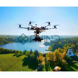
Service Providers We offer drone-based surveying and aerial mapping solutions to capture accurate, high-resolution data from above. The service includes drone surveys for site assessment, generation of orthophotos for precise georeferenced imagery, and progress monitoring to document construction and development over time. This provides valuable visual insights for planning, analysis, and project tracking with efficiency and accuracy.
Updated on2025-09-17
Information on technical characteristics, the delivery set, the country of manufacture and the appearance of the goods is for reference only and is based on the latest information available at the time of publications.

Additional Information

Features

  • Drone surveys and aerial mapping solutions. Drone Surveys. Orthophotos.Progress Monitoring.

Ratings & Reviews

Be the first to write a review
Write a review

Company Information

Name
Georeference Engineering Consultants
About Us
Information on technical characteristics, the delivery set, the country of manufacture and the appearance of the goods is for reference only and is based on the latest information available at the time of publication.